Rock Mapping Understanding the Foundation Beneath Every Project
Introduction
Rock mapping services play a vital role in geotechnical, mining, tunneling, and infrastructure projects by providing a detailed understanding of the subsurface rock structure. Accurate mapping of geological formations helps engineers, architects, and planners make informed decisions about design, excavation, and construction safety.
At The Ground Water Company (GWC), we specialize in comprehensive rock mapping and analysis, combining geological expertise with advanced technology to assess rock formations, structural features, and fracture systems. As a trusted rock mapping consultant, our mission is to deliver precise, data-driven insights that ensure stability, safety, and long-term project success.
What Is Rock Mapping?
Rock mapping is the process of studying, recording, and interpreting the type, orientation, and physical characteristics of rock masses exposed at the surface or during excavation. It provides critical information about rock strength, fracture patterns, fault zones, and groundwater flow pathways all of which influence foundation design and excavation methods.
In large-scale infrastructure, mining, and tunneling works, understanding rock behavior can prevent failures, reduce costs, and enhance construction safety. Leading rock mapping firms like GWC use a blend of field observations, laboratory testing, and digital modeling to provide comprehensive geological assessments.
Our Rock Mapping Process at GWC
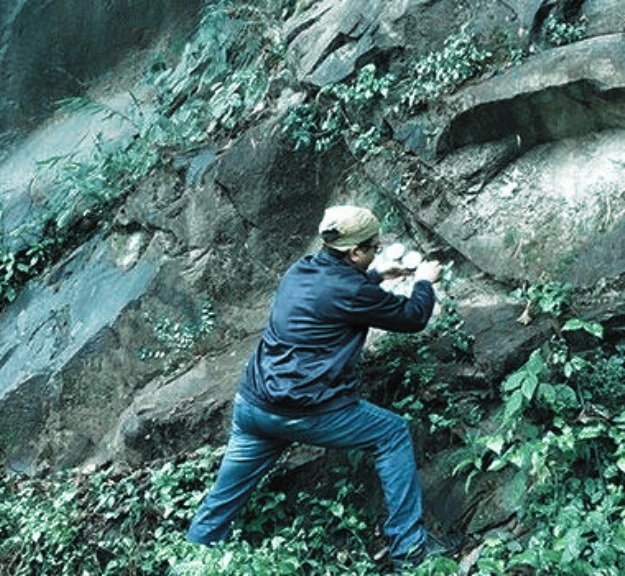
1. Geological Survey & Field Mapping
We begin with detailed field investigations to identify rock types, discontinuities, and joints. Using GPS, drones, and digital mapping tools, our team captures structural and spatial data to develop an accurate geological model of the site.
2. Rock Sampling & Laboratory Testing
Samples collected from outcrops or boreholes undergo laboratory testing for parameters like uniaxial compressive strength, porosity, and weathering grade. These tests help determine the mechanical properties and durability of the rock mass.
3. Rock Structure & Fracture Analysis
We perform fracture mapping, joint analysis, and fault detection to evaluate rock stability. This helps engineers plan excavation, slope stabilization, and support systems effectively.
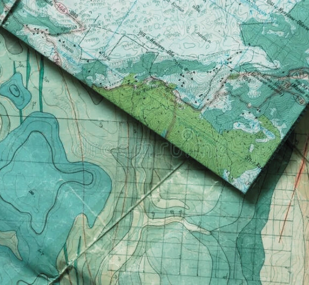
4. 3D Rock Mapping and Visualization
Using 3D modeling software, we transform geological data into visual representations of subsurface structures. This rock mapping and visualization allows clients to assess potential risks, optimize design, and plan construction phases efficiently.
5. Reporting & Engineering Recommendations
Our reports include detailed geological maps, cross-sections, and expert recommendations for foundation design, excavation techniques, and risk mitigation.
Applications of Rock Mapping
- Infrastructure Development: Roads, tunnels, bridges, and metro projects.
- Mining & Quarrying: Identifying safe excavation zones and resource potential.
- Hydropower Projects: Assessing dam foundations and slope stability.
- Construction & Real Estate: Ensuring foundation safety and long-term structural integrity.
- Groundwater & Hydrogeology: Understanding aquifer flow through fractured rock systems.
Benefits of Rock Mapping
- Foundation Safety & Stability
Accurate rock mapping minimizes construction risks by identifying weak zones, faults, and unstable layers before work begins. - Cost Efficiency
Proper geological assessment reduces unexpected excavation challenges and redesign costs, ensuring smoother project execution. - Environmental Protection
Mapping helps in responsible excavation, reducing the risk of landslides, erosion, and groundwater contamination. - Informed Engineering Decisions
With detailed rock structure insights, engineers can choose the right materials, construction methods, and support systems for durability and safety. - Groundwater & Resource Planning
Rock mapping supports hydrological and mining studies by locating fractures that influence groundwater flow or mineral deposits.
Why Choose The Ground Water Company (GWC)?
- Comprehensive Expertise: Skilled geologists, hydrogeologists, and geotechnical engineers with field and lab experience.
- Advanced Technology: Drone-based mapping, 3D modeling, and GIS-integrated visualization tools.
- Customized Solutions: Project-specific analysis for construction, mining, or environmental applications.
- Regulatory Compliance: Adherence to national and international geotechnical standards.
- Trusted Partner: Proven track record in rock mapping projects across India and the Middle East.
Conclusion
Every successful project begins with a strong understanding of what lies beneath. Rock mapping is not just about studying stones it’s about reading the earth’s story to build safely and sustainably.
At The Ground Water Company (GWC), we bring scientific precision, advanced technology, and decades of geological experience to every project. From infrastructure foundations to hydrogeological assessments, our rock mapping expertise ensures that every structure stands on solid ground literally and sustainably.